The Five Geographical Regions of Georgia are the Coastal Plain, Piedmont, Blue Ridge, Valley and Ridge, and the Appalachian Plateau.
The Coastal Plain is the largest size of the geographical regions. It is located south of the fall line and was once a prehistoric ocean shore. The Coastal Plain is the home of the Okefenokee Swamp. This swamp is the second largest swamp in the United States.
|
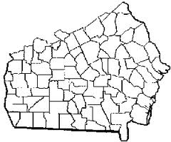
The Piedmont is north of the fall line. It borders the Coastal Plain, Blue Ridge, and the Valley and Ridge regions. The Piedmont is the most highly populated region and is home to Georgia's capital of Atlanta. The Piedmont is home to many forests of oak and hickory trees. It is also called the mid-Atlantic area of Georgia. |
|
|
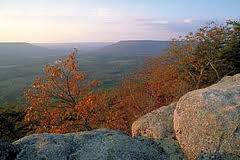
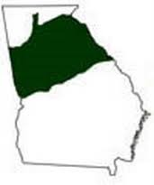
Blue Ridge is named for it's many rocky mountains and ridges that seem to have a dark blue haze around them. The Eastern Continental Divide is located in Blue Ridge. This separates the rivers flowing East into the Atlantic ocean and the rivers flowing West to the Gulf of Mexico. Blue Ridge also has many gorges and canyons such as Tallulah Gorge. |
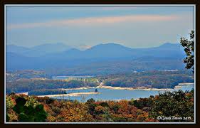
The Valley and Ridge Region is filled with, of course, valleys and ridges. It's topography consists of high peaks with low drops between them. The Valley and Ridge region is layered with different types of rock from different time periods on the side of the canyons.
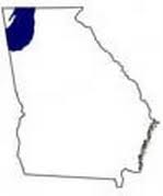
The Appalachian Plateau is in the northwest corner of Georgia. It contains much sedimentary rock and steep, rocky hills. Many fossils from the Paleozoic were found in this region because of it's once shallow sea that has been gone for centuries.